
Surface Water Assessments - Abandoned/Inactive Mine Lands
Ouray, San Miguel, San Juan, Gunnison Counties, Colorado
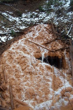
Western Water & Land has conducted surface water assessments at more than 25 abandoned/inactive mine sites throughout western Colorado. The assessments are designed to evaluate the potential threats posed by former mine operations to human health and the environment. The assessments consider all impacted media, including groundwater, surface water, waste rock, tailings, soil, and vegetation. The surface water component of the assessments typically involves drainage from the mine adit; surface water runoff from waste rock and tailings accumulations; and impacts to receiving streams, lakes, and wetland areas.
Our understanding of mine processes and operations is used in conjunction with our geologic and hydrologic expertise to develop assessment strategies tailored to the specific concerns associated with each former mine and /or mill site. The strategies involve selection of the analytical program required to properly assess the threats posed by the site, media to be sampled, sampling methodology, and sample locations. A Sampling and Analysis Plan is prepared for each site to document the assessment strategy and specify sampling procedures and protocols. A site investigation is conducted to obtain the information necessary to assess the general nature and extent of contamination at the site and the relative hazards to human health and the environment posed by the site on the basis of a screening-level risk evaluation.
The data and information obtained to complete the abandoned/inactive mine assessments are stored in in-house databases maintained by Western Water & Land. As a result, we have compiled an extensive database of information for numerous mine discharges and streams throughout southwestern Colorado. Some of the more prominent streams include the San Miguel River, Lake Fork, Howard Fork, Uncompahgre River, Sneffels Creek, Red Mountain Creek, Gray Copper Gulch, Corkscrew Gulch, Oh Be Joyful Creek, and Tomichi Creek.
Ouray, San Miguel, San Juan, Gunnison Counties, Colorado
Western Water & Land has conducted surface water assessments at more than 25 abandoned/inactive mine sites throughout western Colorado. The assessments are designed to evaluate the potential threats posed by former mine operations to human health and the environment. The assessments consider all impacted media, including groundwater, surface water, waste rock, tailings, soil, and vegetation. The surface water component of the assessments typically involves drainage from the mine adit; surface water runoff from waste rock and tailings accumulations; and impacts to receiving streams, lakes, and wetland areas.
Our understanding of mine processes and operations is used in conjunction with our geologic and hydrologic expertise to develop assessment strategies tailored to the specific concerns associated with each former mine and /or mill site. The strategies involve selection of the analytical program required to properly assess the threats posed by the site, media to be sampled, sampling methodology, and sample locations. A Sampling and Analysis Plan is prepared for each site to document the assessment strategy and specify sampling procedures and protocols. A site investigation is conducted to obtain the information necessary to assess the general nature and extent of contamination at the site and the relative hazards to human health and the environment posed by the site on the basis of a screening-level risk evaluation.
The data and information obtained to complete the abandoned/inactive mine assessments are stored in in-house databases maintained by Western Water & Land. As a result, we have compiled an extensive database of information for numerous mine discharges and streams throughout southwestern Colorado. Some of the more prominent streams include the San Miguel River, Lake Fork, Howard Fork, Uncompahgre River, Sneffels Creek, Red Mountain Creek, Gray Copper Gulch, Corkscrew Gulch, Oh Be Joyful Creek, and Tomichi Creek.