
Surface Water Hydrology
|
|
|
Western Water & Land offers extensive experience in the assessment and analysis of surface water resources. Surface water hydrology, along with groundwater hydrology, is a fundamental component of the services we provide our clients throughout the region. The natural inter-relationships between surface water and groundwater require a thorough understanding of processes in both fields. Our hydrologists have well-balanced experience in both surface water and groundwater applications. This experience stems from traditional instruction and training at distinguished universities and many years of practical application.
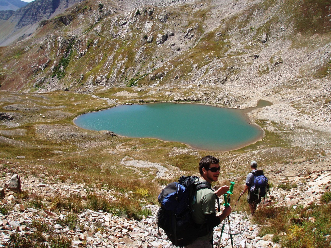
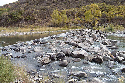
Our comprehensive hydrologic expertise allows us to offer a broad array of surface water services. The breadth of our surface water services extend from “upstream” projects such as delineation, protection, and supply of raw water resources through “midstream” projects” including channel morphology and bank stabilization to “downstream” projects involving forensic hydrology, water treatment, and remediation. Our surface water services are commonly coupled with the other disciplines we offer, such as water chemistry, water rights, and water resource protection.
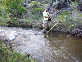
Our hydrologists are particularly skilled at developing and implementing cost effective, data collection programs designed to obtain the field information and data required to meet project objectives. We recognize the importance data integrity and utilize strict field procedures and quality assurance/quality control protocols to ensure the data we collect meet our high-quality expectations and support defensible hydrologic interpretations and analyses.
To complement our field testing expertise, we offer comprehensive data assessment, interpretation, and analysis services. Our hydrologists have the knowledge to correctly apply hydrologic principles and processes and the experience and training to provide defensible data interpretations. When applicable, we utilize various quantitative predictive tools and numerical computer models for surface water projects. Our experienced staff has the judgment to apply the appropriate model for any given scenario. Examples of applied programs include U.S. Corps of Engineers’ hydrologic engineering and planning analysis software such as HEC-RAS and HEC-HMS, stormwater runoff models such as HydroCAD®, stream depletion models such as Well Pumping Depletion Model®, historic consumptive use models such as StateCU, and geochemical models such as PHREEQC.
Water chemistry analysis is a critical component of almost every surface water investigation. Western Water & Land has broad experience in geochemical sampling, analysis, and data interpretation. The knowledge of geochemical relationships allows Western Water & Land to design complete yet practical water quality monitoring programs. Coupled with our water chemistry expertise, we offer complete database development and management services. Using our expertise in managing environmental data, we have developed project-specific databases using common office software (MS Access and Excel) that not only store project data, but also perform data QA/QC, statistical analyses, run pre-programmed queries, compare results against regulatory standards, and provide custom reports that retrieve desired data in a matter of minutes.
For many of our surface water projects, we use ArcGIS to display and enhance our data interpretations and analyses. Coupling our database expertise with GIS provides a powerful tool for compilation, analysis, and management of project data in a geographical format.
Our comprehensive hydrologic expertise allows us to offer a broad array of surface water services. The breadth of our surface water services extend from “upstream” projects such as delineation, protection, and supply of raw water resources through “midstream” projects” including channel morphology and bank stabilization to “downstream” projects involving forensic hydrology, water treatment, and remediation. Our surface water services are commonly coupled with the other disciplines we offer, such as water chemistry, water rights, and water resource protection.
Our hydrologists are particularly skilled at developing and implementing cost effective, data collection programs designed to obtain the field information and data required to meet project objectives. We recognize the importance data integrity and utilize strict field procedures and quality assurance/quality control protocols to ensure the data we collect meet our high-quality expectations and support defensible hydrologic interpretations and analyses.
To complement our field testing expertise, we offer comprehensive data assessment, interpretation, and analysis services. Our hydrologists have the knowledge to correctly apply hydrologic principles and processes and the experience and training to provide defensible data interpretations. When applicable, we utilize various quantitative predictive tools and numerical computer models for surface water projects. Our experienced staff has the judgment to apply the appropriate model for any given scenario. Examples of applied programs include U.S. Corps of Engineers’ hydrologic engineering and planning analysis software such as HEC-RAS and HEC-HMS, stormwater runoff models such as HydroCAD®, stream depletion models such as Well Pumping Depletion Model®, historic consumptive use models such as StateCU, and geochemical models such as PHREEQC.
Water chemistry analysis is a critical component of almost every surface water investigation. Western Water & Land has broad experience in geochemical sampling, analysis, and data interpretation. The knowledge of geochemical relationships allows Western Water & Land to design complete yet practical water quality monitoring programs. Coupled with our water chemistry expertise, we offer complete database development and management services. Using our expertise in managing environmental data, we have developed project-specific databases using common office software (MS Access and Excel) that not only store project data, but also perform data QA/QC, statistical analyses, run pre-programmed queries, compare results against regulatory standards, and provide custom reports that retrieve desired data in a matter of minutes.
For many of our surface water projects, we use ArcGIS to display and enhance our data interpretations and analyses. Coupling our database expertise with GIS provides a powerful tool for compilation, analysis, and management of project data in a geographical format.
Western Water & Land provides the following surface water hydrology services:
|
|